Record-Breaking supercell storm hammers South-East Queensland.

Record‑Breaking Supercell Carves a 1,400 km Path Through Queensland: What Happened, Why It Was So Severe, and What’s Next
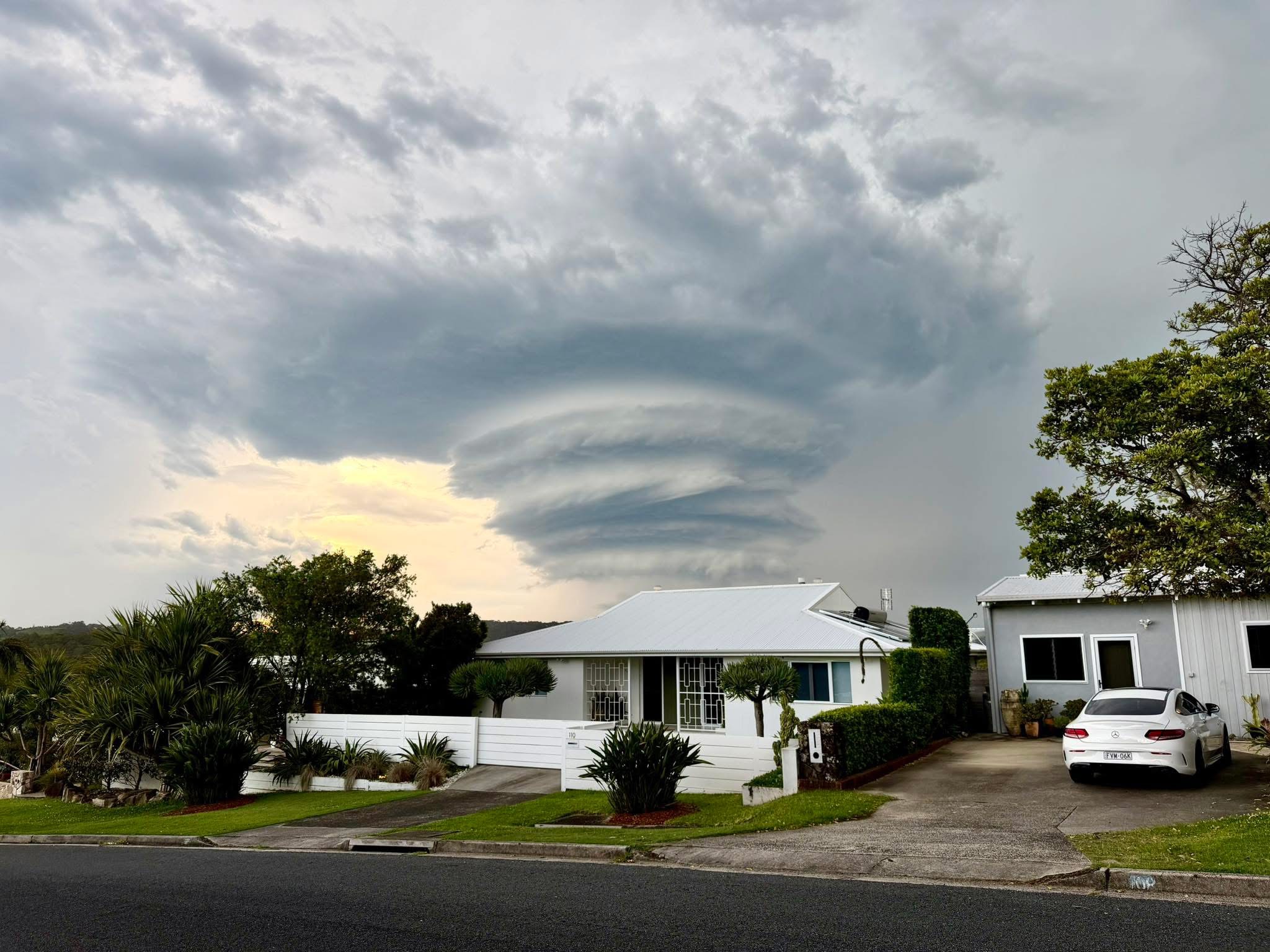
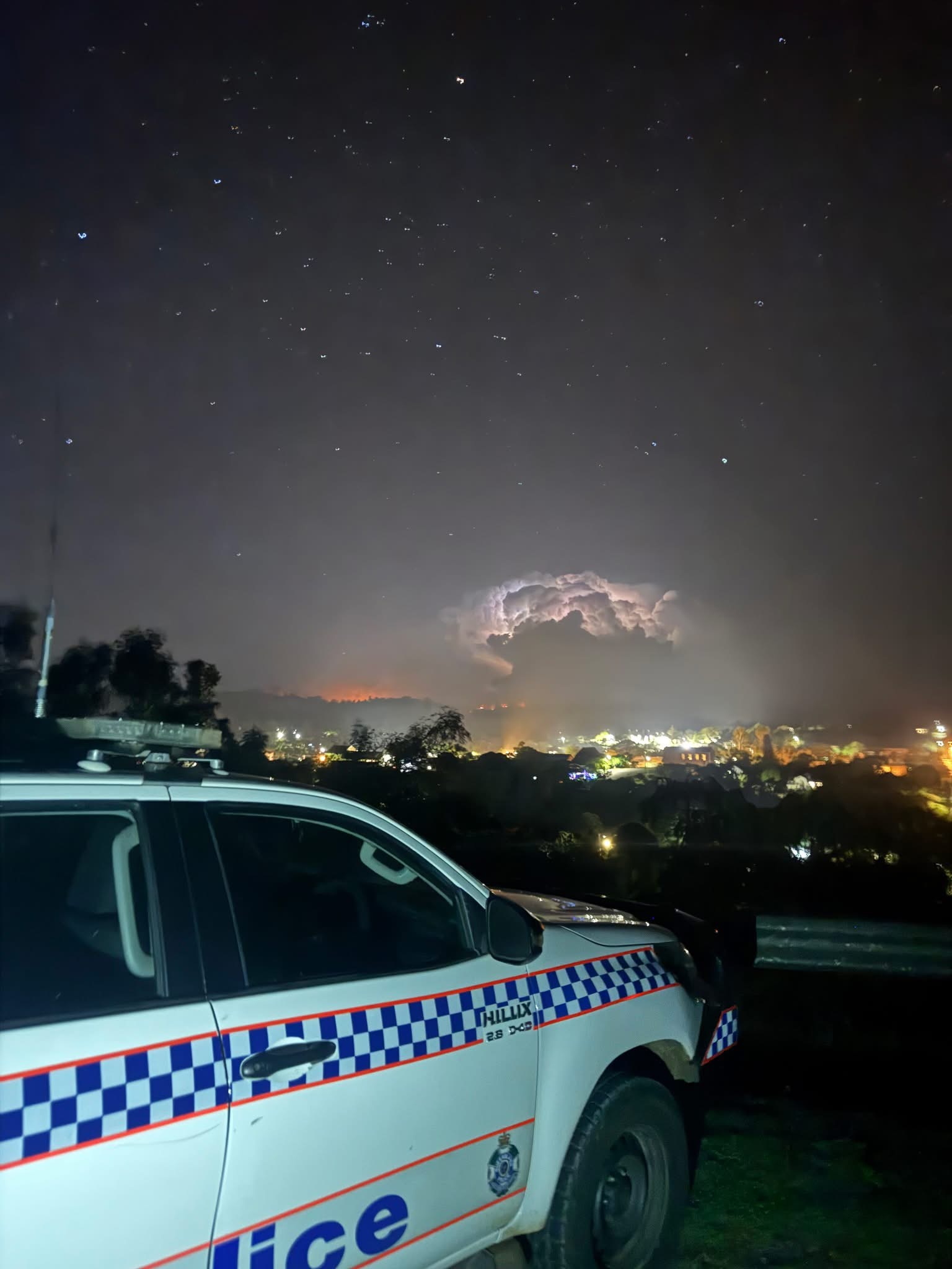
On Monday, 24 November 2025, a long‑tracked supercell tore from northern NSW into Southeast Queensland and then north along the coast, producing giant hail (up to 15cm), destructive winds (up to 130 km/h), and mass power outages.
Coastwatch’s Josh Toohey (also of CyclonesOz) described the event as “record‑breaking” for hail alone and traced its path from near Lismore through the Gold Coast, Brisbane, Moreton Bay, Sunshine Coast, the Fraser and Capricornia Coasts, to the Whitsundays, finally dissipating near Mackay around 7:00 a.m. Tuesday after an estimated 1,400 km run.

The Storm: Timeline and Impacts
- Formation and Track:
The cell originated just north of Lismore and strengthened as it pushed through the Gold Coast Hinterland into Brisbane/Moreton Bay, then Sunshine Coast–Noosa, cutting inland near Tin Can Bay before continuing north alongside the Capricornia coast. Toohey’s analysis notes an unusually long, coherent supercell structure persisting into the Whitsundays, with final dissipation near Mackay around 7 a.m. Tuesday.
- Hail and Wind Extremes:
The Bureau of Meteorology logged 11 cm hail at Ferny Hills and Manly (Brisbane bayside) and winds 107 km/h at Brisbane Airport and 100 km/h at Maroochydore. Additional posts cite 12–14 cm stones, and one up to 15cm (see below), in suburbs such as Gumdale/Chandler and parts of Logan/Redlands.

- Outages and Damage:
Power provider Energex reported 150,000+ customers off supply at the peak, ~600 downed powerlines, and a lightning barrage initially tallied near 525,000 strikes, with some follow‑up tallies reported higher as data reconciliation continued. The State Emergency Service fielded hundreds to thousands of calls, with widespread roof damage, toppled trees, and transport disruptions (including airport delays). - Insurance and Recovery:
The Insurance Council of Australia declared an Insurance Catastrophe (CAT), with 16,000+ claims lodged across 140+ postcodes by Tuesday and warnings that numbers would rise as assessments continued.
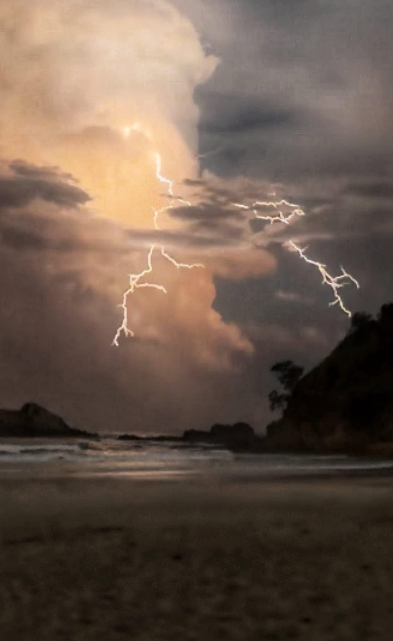
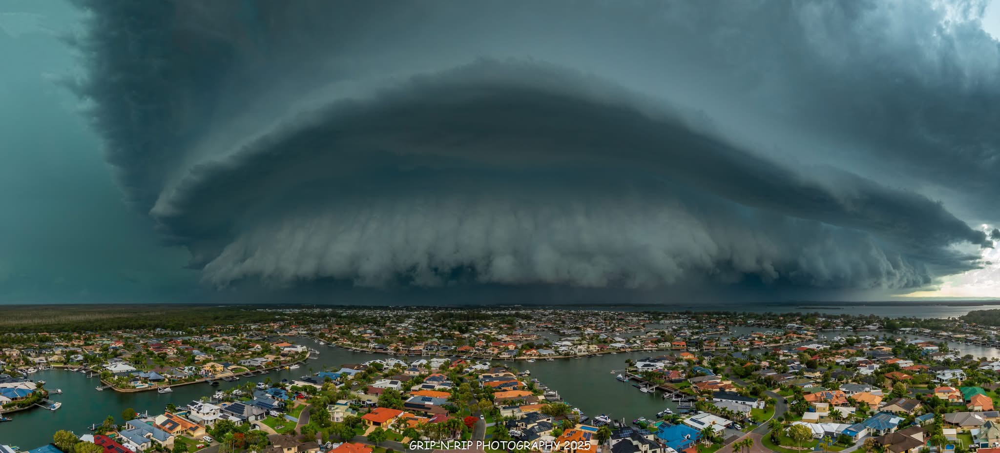 Amazing shot by Grip-N-Rip Photography of the storm front bearing down on Bribie Island. Bribie suffered significant damage with ferocious wind and hail
Why This Event Was So High‑End: Expert Context from Anthony Cornelius
Meteorologist Anthony Cornelius of Weatherwatch has been vocal in explaining the ingredients behind recent severe setups in SE QLD/NE NSW:
- Shear + Instability = Supercells:
Cornelius highlighted days with 40–50 kt bulk shear, as a key litmus test for supercell formation when combined with strong instability in a hot, humid airmass. That pairing makes giant hail and destructive winds more likely once discrete supercells form. - Coastal Modulation and Dryline Positioning:
He also cautioned that when the dryline/trough sits well inland (e.g., Western Downs), coastal areas can still be hit, but the peak intensity often occurs earlier and farther west as storms mature and then pulse in/out while tracking coast‑ward. That lends insight into Monday’s pattern: severe potential was widespread, with coastal impacts depending on storm longevity and cycles as cells moved northeast at 50–60 km/h.

- Operational Radar & Communications Friction:
In late October, there was signficant public criticism of the new BoM website/radar rollout, citing lag, undercooked intensity depiction, and discoverability issues that, in the view of many analysts including Toohey and Cornelius, complicated public situational awareness during severe weather. This scrutiny has continued to compound and will be the subject of future reporting at Coastwatch. This underscores the importance of multi‑source monitoring during fast‑evolving storm days.
Why The South-East is Susceptible to Severe Hail
Cornelius explains via Weatherwatch that Southeast Queensland is inherently prone to hailstorms due to its location in Australia’s “severe thunderstorm alley.” Fuelled by hot, humid days capped by periodic cold air aloft—along with strong upper-level winds and triggers like troughs, sea-breezes, and mountain ranges; the perfect conditions for giant hail are often created.
He emphasizes that while this week’s supercell was extreme in scale, it wasn’t unprecedented; such events are part of a well-established seasonal pattern. This is particularly relevant now, as Southeast Queensland has experienced ten giant-hail days in just six weeks, close to twice the typical frequency, driven by climate drivers like a negative SAM, negative IOD, weak La Niña, and marine heatwaves. In short, while Monday’s storm was high-end, it falls within the realm of expectation for a region accustomed to potent storm setups.
Localised Highlights
- Bribie Island saw roofs ripped, with Moreton Bay one of the hardest‑hit outage zones.
- Coolum (Sunshine Coast) reported close calls with falling trees as the storm passed.
- Logan/Redlands had numerous reports of 10–12 cm hail, smashed solar, and vehicle damage.
- Airport Operations: Brisbane Airport recorded 107 km/h gusts and temporary ground stops.

How Josh Toohey Called It (and What’s Ahead)
- Toohey characterized Monday’s event as “one of the worst storms in recent times” for SEQ, with the storm’s 1,400 km longevity and record‑scale hail the standout.
- Josh advised the Coastwatch audience in his Weekend Outlook that while Friday and Sunday would offer pleasant boating/fishing windows, Saturday afternoon carried renewed thunderstorm risk, with 55–60 kt (≈100–110 km/h) gust potential in more severe cells approaching coastal/exposed areas—consistent with subsequent public warnings issued in the region.
Some positive change — updated outlook
Josh notes that Saturday’s storm setup is likely to be far less intense than Monday’s supercell outbreak, bringing some respite from the extreme conditions. Instead of giant hail and long-lived supercells, expect scattered, disorganized thunderstorms sparked by an eastward-moving trough from late morning into the evening.
These storms may still produce heavy rain (10–30 mm, isolated up to 60 mm) and damaging wind gusts, mainly across inland regions like the Central Highlands, Burnett, and Maranoa, before reaching parts of the Sunshine Coast, Brisbane, and the Gold Coast, later in the day. A secondary risk exists for a patchy squall line forming after 6 p.m. near the NSW border and moving toward Ipswich and Brisbane, but confidence remains low. Josh stresses that Saturday is not a high-end day—it’s a chance for many areas to see beneficial rain rather than destructive storms, marking a welcome shift from the recent run of extreme weather.
Safety, Prep, and Information Hygiene
- During Giant‑Hail Supercells:
Shelter immediately; away from windows; vehicles under cover; avoid floodwaters and downed lines. Secure loose items, charge devices, and stay off roads unless essential during warnings. - Multi‑Source Monitoring:
Given the radar/comms concerns raised by Cornelius and others, use multiple channels: Weatherwatch, Coastwatch & CyclonesOz, BoM warnings/apps, local media, and other trusted analysts. Redundancy increases situational awareness during rapidly intensifying cells.
Fast Facts (Mon 24 Nov 2025)
- Peak hail sizes: 11–14 cm (various suburbs across Brisbane/Redlands/Logan; 11 cm confirmed at Ferny Hills & Manly).
- Peak wind gusts: 107 km/h (Brisbane Airport), 100 km/h (Maroochydore).
- Lightning: ~525,000 strikes recorded in one afternoon (preliminary tallies).
- Outages: >150,000 customers at peak; ~600 downed powerlines reported.
- Insurance: CAT declared; 16,000+ claims lodged by Tuesday.
Video above Recorded from the Rainbow Bay Surf Club — courtesy Coolangatta Community (Facebook).
Credits & Sources
Primary recap: Josh Toohey (Coastwatch Weekend Weather Outlook, 26–27 Nov 2025).
Event reporting & measurements: ABC News (hail sizes, winds, outages, lightning), Tony Auden & 7NEWS(hail/winds/outages).
Expert context: Anthony Cornelius analysis on shear/instability & risk distribution, commentary on BoM radar rollout issues.
(Above) Hail hammers Manly (Queensland) foreshore and harbour.
Story — Coastwatch Team.
STAY UP TO DATE with our COASTAL WEATHER OUTLOOK and the COASTWATCH WEATHER PAGES.

More Articles
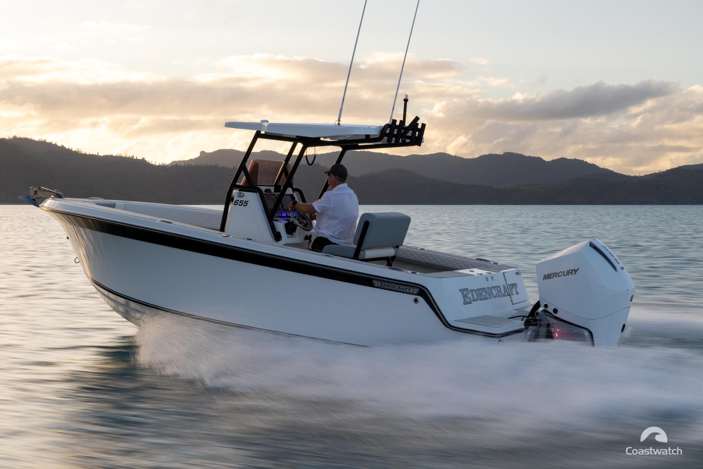
Edencraft East Coast Tour
Coastwatch linked up with Edencraft’s Australian East Coast tour at their final destination, Airlie Beach — on a spectacular day in the Whitsundays — to sample their latest release, the impressive ...
Yamaha Motor Australia Acquires Telwater in Major Marine Industry Shift
In a significant development for Australia’s marine industry, Yamaha Motor Australia Group has acquired Telwater Pty Ltd, the nation’s largest aluminium boat manufacturer — housing iconic brands including Quintrex, ...