Issued at 5pm 29th February 2024 for Saturday 2nd & Sunday 3rd March 2024

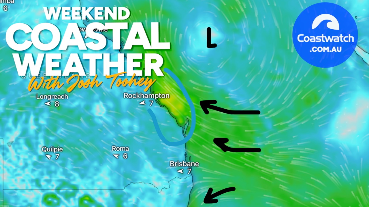
Charts: The charts and weather models are indicating that the back edge of a weak high in the Tasman Sea will be over the SE Qld coast on Saturday and Sunday. A Southerly change is on the NSW coast and is currently expected to push through the SE Qld coast on Sunday night or Monday morning

Saturday: It looks like being a sunny day with a top temperature around 30 degrees. Wind is forecast to be 5-10kts NW early, becoming 10kts N/NE during the day, reaching 10-15kts in the afternoon
Sunday: Looks like being sunny in the morning, becoming cloudy in the afternoon, particularly on the Gold Coast and Moreton Bay as showers and storms develop ahead of the Southerly change to the south. Wind and top temperature should be similar to Saturday
Sailing & Boating: Based on those predictions, there should be enough wind for sailing and boating conditions in offshore and open waters should be good in the mornings, becoming a bit choppy in the afternoons. The best cruising and anchorages will be in the sheltered waters in the rivers and creeks and from Caloundra to Donnybrook in Pumicestone Passage and the southern bay from Peel Island to the northern parts of Southport Broadwater.
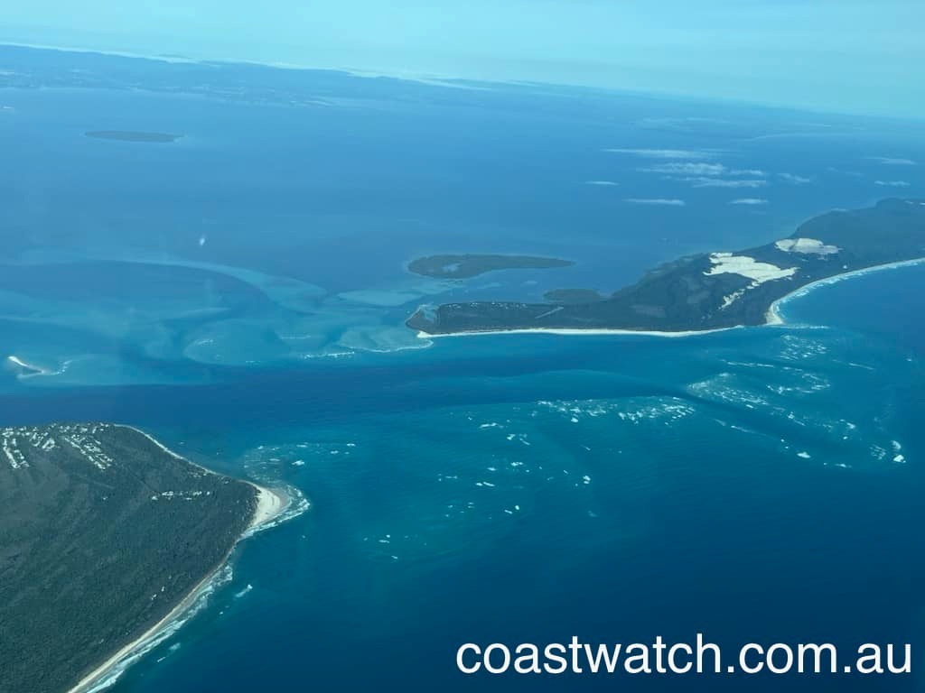
Swell & Coastal Bars: The swell offshore is expected to be Easterly at about 1m and it should be a bit smaller inshore and on the coastal bars. Based on that, South Passage Bar should be workable with the usual caution required when crossing and Noosa, Jumpinpin and Currumbin Bars are shallow right across, but workable if you have local knowledge. We got this aerial shot of South Passage Bar a week ago and it shows the banks and channels and wouldn’t have changed much since it was taken
Tides: It’s third or last quarter of the moon on Monday night, which means neap tides. Neap meaning smaller tidal differences than around full and new moons. There’s morning lows and afternoon highs and you can click this link for precise tide times and heights
Fishing & Surf & Beach Info: Also on our web site is the latest SE Qld Fishing Report published every Thursday afternoon … and if you’re going surfing or to the beach, the daily Surf & Beach Report which is published about 5.30 every morning
More Articles
COASTAL WEATHER OUTLOOK for South East Qld — February 12th
Issued 9pm Thursday February 12th. Wet Conditions Ahead -- Heavy Rain and Severe Storms Expected This Weekend. Southeast Queensland is set for a very damp weekend as a series of low‑...
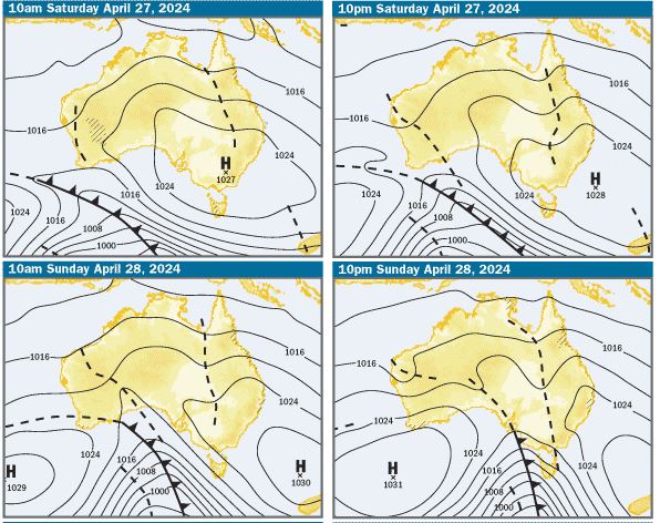
Issued at 5.15pm 25th April for 27th & 28th April 2024
Charts: The charts and weather models are indicating that there’ll be a large high pressure system centred over Victoria on Saturday morning, moving into the...
COASTAL WEATHER OUTLOOK for South East Qld — January 30th
Boaters across South East Queensland can expect mixed conditions this weekend, with Sunday shaping up as the best day to get out on the water. Friday and Saturday will see ...