Issued at 5.15pm 2nd May for 4h & 5th May 2024
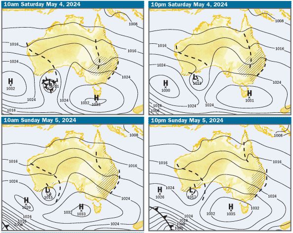
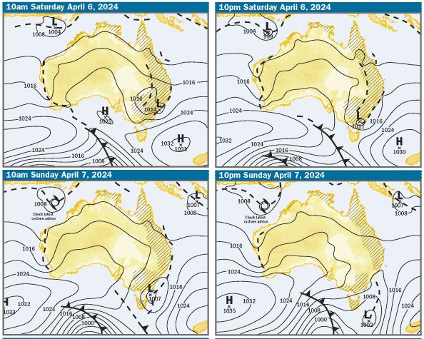
Charts: The charts are indicating that on Saturday, there’ll be a large high pressure system centred near Tasmania extending a ridge along the Qld Coast, which will generate moderate to fresh SE winds. On Sunday, the charts indicate the centre of the high could slip back westward and be centred over the eastern Great Australian Bight, which should decrease the ridge along the coast and the winds may ease to be light to moderate SE in the morning, and light E/SE in the afternoon. There’s also a trough laying very close to the NSW and southern Qld coasts, which looks pretty stationery and will likely trigger showers and possibly storms along the coast and have some effect on wind speed and direction

SE Qld Weather Outlook: On both days this weekend, The BOM forecasts are saying there’s a high chance of showers and possible storms south of Cape Moreton in the afternoons. On Saturday, winds in offshore waters north of Cape Moreton should be 15-20kts SE during the day, turning Easterly at 10-15kts during the evening and for offshore waters south of Cape Moreton, the wind forecast is much the same, but turning Easterly during the afternoon.
On Sunday, the forecast for offshore waters north of Cape Moreton is for 10-15kt Easterly winds in the morning, becoming SE during the day. South of Cape Moreton, the forecast is for 10-15kts E/SE winds in the morning, easing to 10kts and tending S/SE during the day
On Moreton Bay, the forecast is for 15-20kts SE winds on Saturday morning, easing to 10-15kts during the afternoon and decreasing further to about 10kts in the evening. On Sunday, the forecast is for S/SE winds about 10kts. As is usual at this time of year, there’s likely to be light S/SW land breezes inshore early. It should be noted that things can change, so it’s always a good idea to check the latest forecasts before enjoying coastal activities
Tides & Moon: It’ll be new moon next Wednesday night, so tidal differences are increasing over the next week. On the weekend, there’ll be early morning and early evening highs and lows in the middle of day. Click this link for precise tide times and heights at various locations
Swell & Coastal Bars: There’s been a 2m plus S/SE swell in offshore waters, which might decrease a bit over the weekend. It’s much smaller as it refracts onto the coast and more E/SE. Expect the swell on the coastal bars to be about 1m E/SE, with possible bigger set waves. As always, take care crossing bars, particularly on the ebb tides when the water running out through narrow bar channels can create pressure waves, which are bigger than swell size and break unpredictably
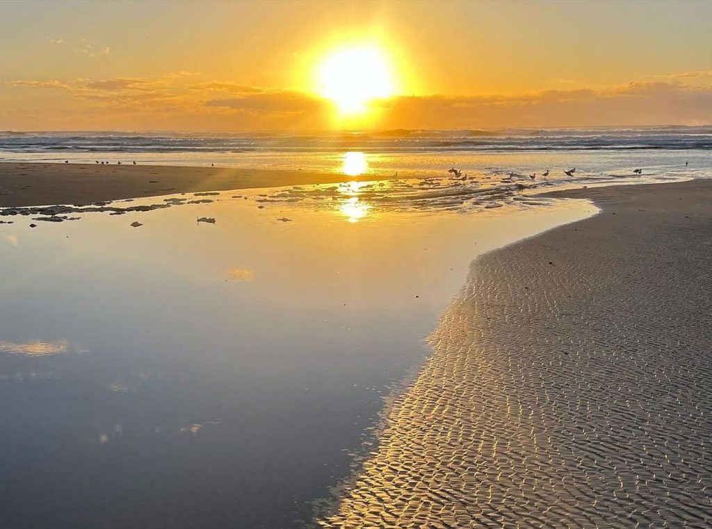
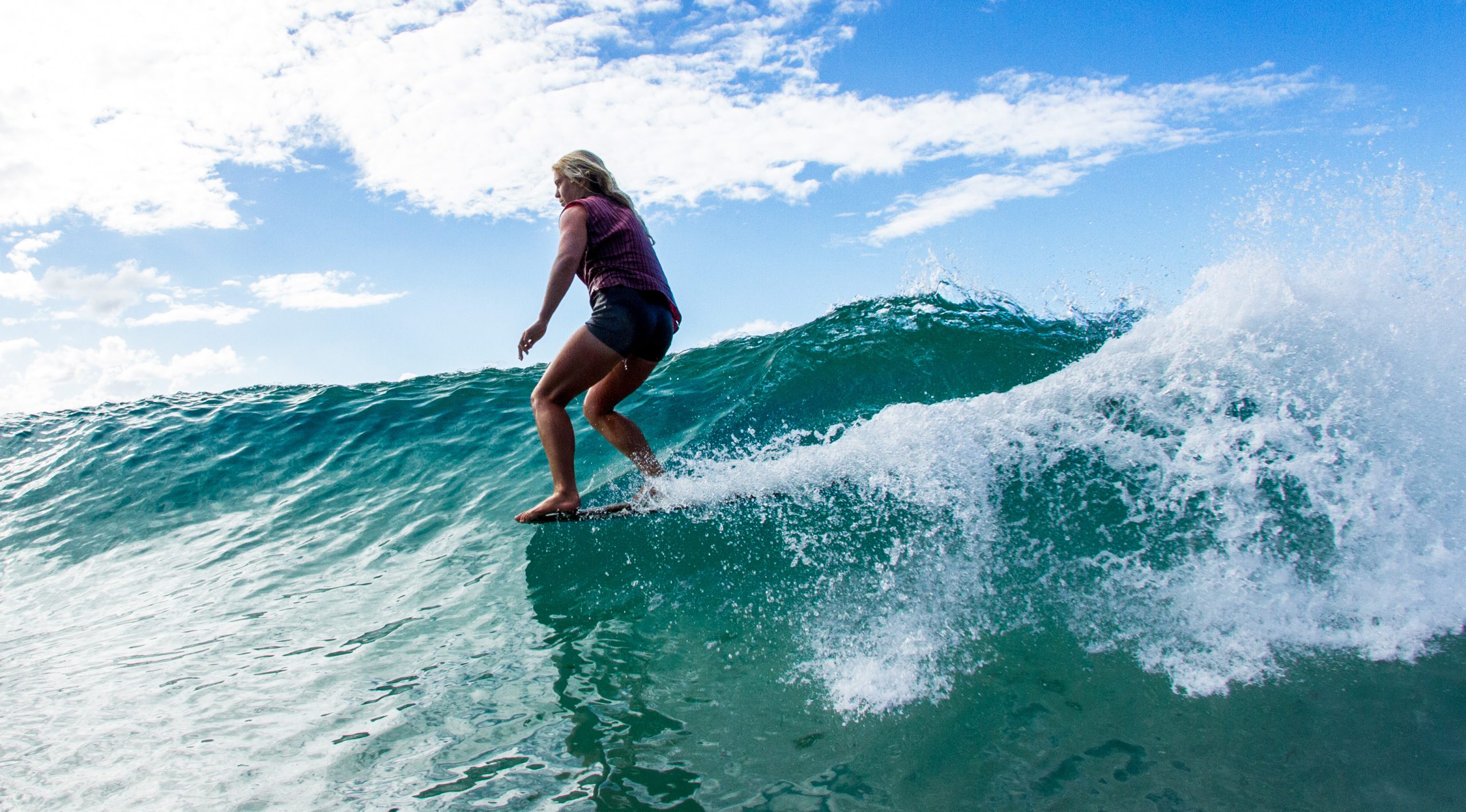
Pic below Noosa Bar Monday thanks to Around Noosa https://www.facebook.com/aroundnoosa
Sailing & Boating: Based on the weather predictions, with showers and possibly storms predicted both days, it’ll be a good idea to take wet weather gear. It looks like good wind for sailing on Saturday and light winds on Sunday. Boating conditions in open Moreton Bay waters will choppy on Saturday and pretty good on Sunday. As usual, the best cruising and anchorages will be in the sheltered waters from Caloundra to Donnybrook in Pumicestone Passage, the southern bay from Peel Island to the northern parts of Southport Broadwater and in the rivers and creeks. In offshore waters, it looks like being pretty lumpy in offshore waters on Saturday and improving on Sunday if the wind eases as forecast.
Fishing: Based on the forecasts, on Saturday, it’s looking like conditions will be borderline for offshore fishing and a bit lumpy in open bay waters, improving on Sunday if the winds ease as predicted. The best fishing conditions will be in the sheltered waters in Pumicestone Passage, in the southern bay and the rivers and creeks. To help you plan your weekend angling, the latest SE Qld Fishing Report was published on the Coastwatch web site this afternoon
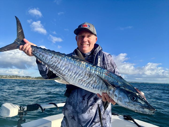
Pic Below – Dave Granville – Spanish Mackerel caught off Caloundra Tuesday – from Caloundra Fishing World https://www.facebook.com/caloundrafishingworld
Surf: Based on the weather and swell predictions, expect the swell to be about 1-1.2m E/SE on the northern ends of the Gold and Sunshine Coasts and along the Tweed Coast. It should be 0.75-1m E/SE in the bays on the northern side of the headlands. Given the forecast for SE or S/SE winds, the cleanest waves will be on the points and in those bays, but will be crowded. If the wind is light S/SW early in the mornings, there should be some less crowded beach breaks on the open beaches. You can check the latest surf conditions with the daily Surf Report published about 5.45 every morning
Beach: The weather outlook indicates showers, with sunny breaks, so a mixed bag for going to the beach. In the forecast S/SE or SE winds, the bays on the northern side of the headlands at Noosa, Mooloolaba, Burleigh, Kirra, Greenmount and Rainbow Bay will be the most pleasant places to be. There’s inshore holes and gutters, particularly on the open stretches of beach and on the ebb tides, any rips working around those features will be enhanced as the water drains off the beach, so swim in the patrolled areas marked by the red and yellow flags. For the latest beach conditions, check our daily Beach Report published about 5.40 every morning


More Articles
Issued at 5.30pm 4th April 2024 for 6th & 7th April
Charts: The charts and weather models are indicating that there’ll be a big high in the Tasman Sea extending a ridge along the Qld Coast. A trough is expected......