Tropical Cyclone Koji Intensifies: Weather Update
Severe Weather: Tropical Cyclone Koji forecast as Category 2, January 10th 2026
By Josh Toohey, Coastwatch
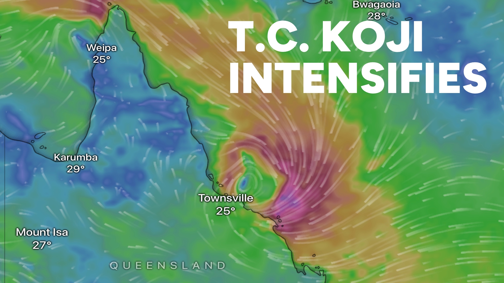
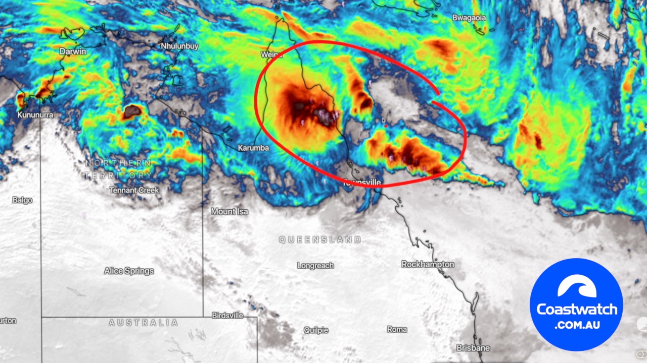
Tropical Cyclone Koji has formed near Queensland.
Special update as Tropical Cyclone Koji has formed just now offshore from Townsville, and is forecast to cross the coast as a category 2 strength tropical cyclone with wind gusts up to 140km/h, and up to 500mm of rainfall early tomorrow morning, near Ayr (Southeast of Townsville).
This will be a significant impact with some substantial damage to trees, crops and roads in the region as a result of wind and rainfall. The strongest winds are likely to be between Townsville down to Airlie Beach, with emphasis on the Bowen area.
Flooding is a serious concern around the Whitsundays coast and Mackay, where the heaviest rainfall will occur tonight and through tomorrow as the storm makes its landfall.
Stay safe, stay informed and make sure you are ready as this weather situation increases for Queensland
BEACH SIGNS

More Articles
COASTAL WEATHER OUTLOOK for Qld — March 6th, 7th, 8th 2026
Issued 6:45pm, March 5th. A turbulent few days are ahead for much of the Queensland coastline, with a developing tropical low, strengthening troughs, and shifting wind patterns shaping conditions ...
Rod’s Weekend Coastal Weather Conditions
Rod’s Weekend Coastal Weather Conditions For the first week of February 2024.
COASTAL WEATHER OUTLOOK for South East Qld — February 5th
Boaters across southeast Queensland and northeastern New South Wales can expect generally calm conditions this weekend, with light winds, low swell and no rain or storms forecast.