Gold & Sunshine Coast Report Issued 5.35am 5th February 2024
Wind:
Gold Coast: Light NE this morning, becoming 10-15kts this afternoon
Sunshine Coast: light E/NE this morning becoming 10-12kts this afternoon
Swell:
There’s a 1.5m SE swell offshore, but it refracting onto the coast more Easterly and is smaller, about 0.5-1m and uneven
Tides:
High: 4.30am & 4.15pm … Low 11am
Best waves:
The wind blew onshore all night. It’s very light now but wave quality is poor and based on the wind forecast, won’t improve during the day. There’s a few lumpy peaks at Duranbah so if you’re desperate for a surf, there, or a trip south of the border might find a bit more size and power.
Best Beaches:
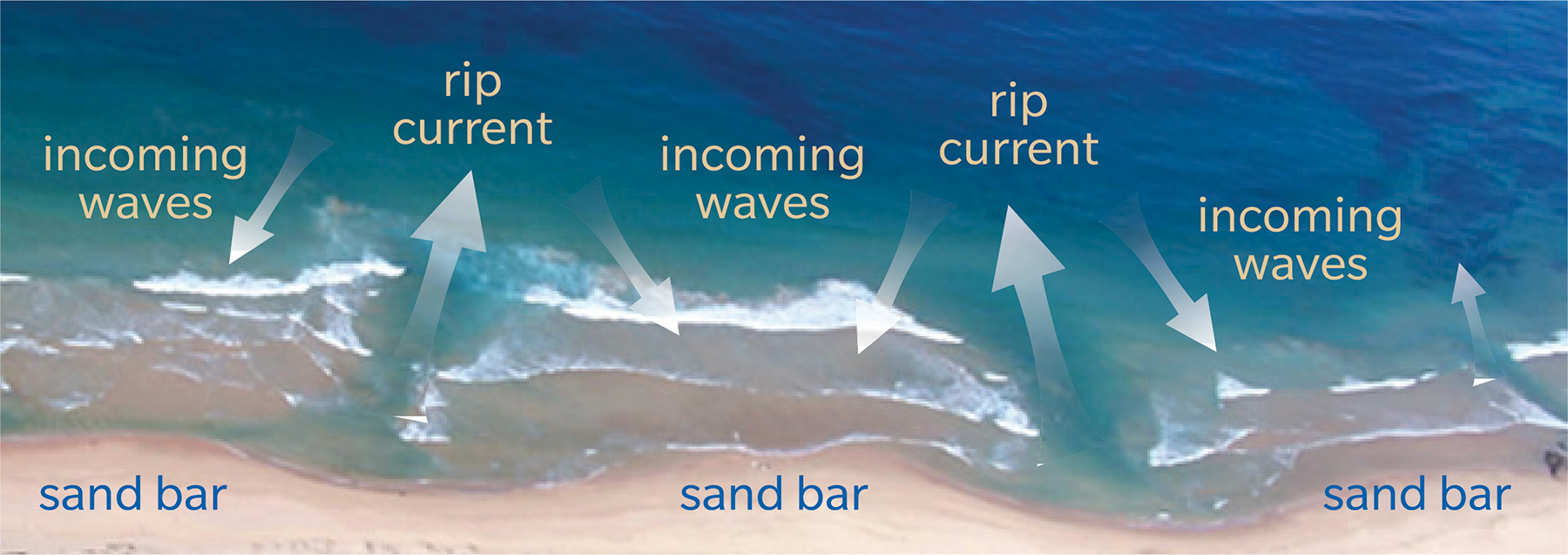
The forecast is for a partly cloudy day on the Gold Coast and sunny on the Sunshine Coast. Make sure you use sun protection and swim only in the patrolled areas marked by the red and yellow flags, particularly this morning on the ebb tide, when the water draining off the beach enhances the rips and sweep working around the inshore holes and gutters
Regarding rips and sweep, we recommend you have a look at the Learn to Read the Beach article on this page and look at the videos on how to spot and survive rips below this report
With onshore winds for the past couple of days, bluebottles may have been blown or washed inshore. Check along the tide line before you go in the water, look for stinger warning signs in the patrolled areas, or ask the beach patrol if there’s any about

More Articles
Gold & Sunshine Coast Report Issued 5.30am 8th February 2024
Light S/SE early, forecast to become 10-15kts SE this morning, freshening to 15-20kts during the day
Gold & Sunshine Coast Report issued at 5.40am Tuesday 9th April 2024
Weather Forecast: Partly cloudy with a top temperature of 28 degrees
Gold & Sunshine Coast Report Issued at 5.40am 4th March 2024
The forecast is for a cloudy day with a high chance of showers and storms, ahead of and with a SE change which should come through the Gold Coast this ...