Sunshine Coast
Sunshine Coast Waters: Double Island Point to Cape Moreton Forecast
By the Bureau of Meteorology
Today’s weather chart

Sunshine Coast Waters: Double Island Point to Cape Moreton Forecast
By the Bureau of Meteorology
A high [1021 hPa] in the Tasman Sea extends a ridge over the south Queensland waters. A weak trough will move east across the south Queensland waters late on Thursday. A new high will move into the Tasman Sea on Friday, extending a new ridge over the south Queensland waters.
Forecast issued at 01:03 am EST on Wednesday 26 June 2024.

Forecast for Wednesday until midnight
| Wind | North to northeasterly about 10 knots. |
| Seas | Below 1 metre. |
| Swell | East to southeasterly below 1 metre. |
| Weather | Partly cloudy. |
Thursday 27 June
| Wind | Variable about 10 knots. |
| Seas | Below 0.5 metres. |
| Swell | Easterly around 1 metre. |
| Weather | Cloudy. 80% chance of showers. |
Friday 28 June
| Wind | Southerly 10 to 15 knots tending southeasterly during the afternoon. |
| Seas | Around 1 metre. |
| Swell | Northeasterly around 1 metre. |
| Weather | Partly cloudy. 60% chance of showers. |
Current Weather
Latest BOM Weather Stations Data
Anemometer Location: Lat -26.601 Lon 153.09. 3.42 m above sea level.
- Wind NNW 6kts
- Gusts 6kts
- Temp 20.7°C
- Rain 15:20pm 0mm
Anemometer Location: Lat -26.644 Lon 152.938. 53.24 m above sea level.
- Wind N 1kts
- Gusts 2kts
- Temp 21.6°C
- Rain 15:20pm 1.2mm
Anemometer Location: Lat -26.391 Lon 153.04, On rolling ground. 6.5 m above sea level. 4km from coast.
- Wind N/A
- Gusts N/A
- Temp 21.4°C
- Rain 15:20pm 0mm
Anemometer Location: Lat -26.959 Lon 152.962. 48 m above sea level.
- Wind N/A
- Gusts N/A
- Temp 21.2°C
- Rain 15:20pm 0mm
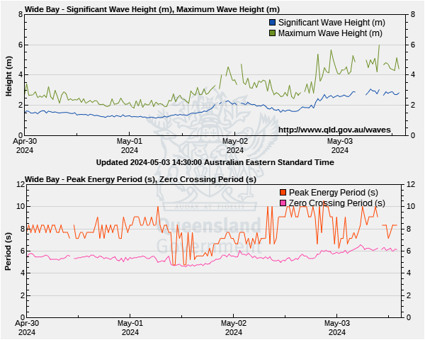
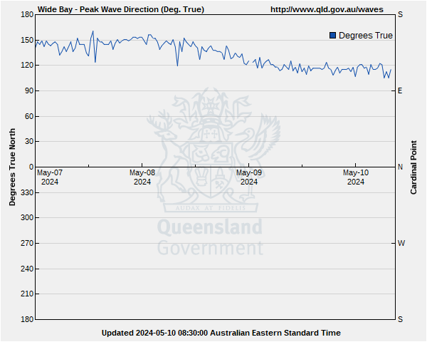
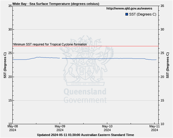
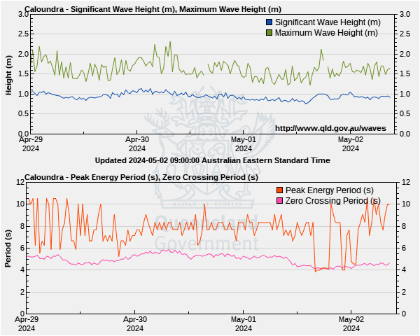
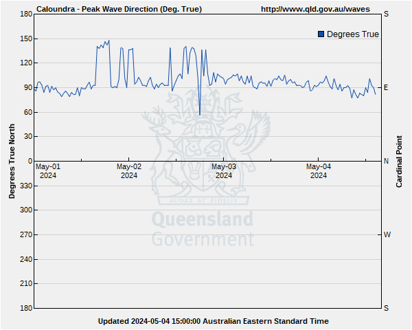
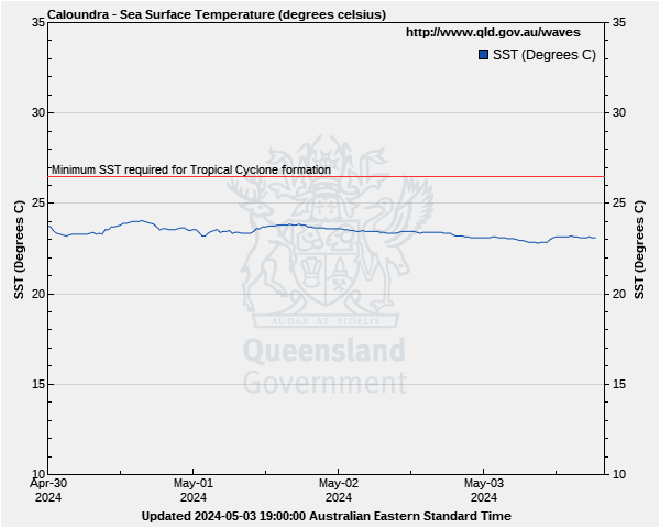
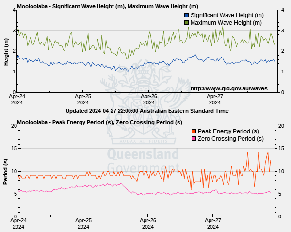
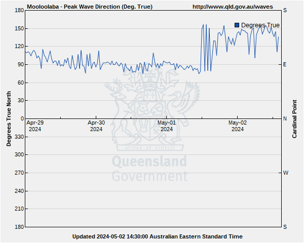
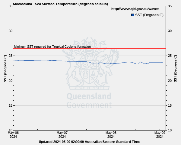
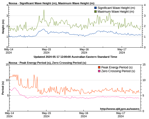
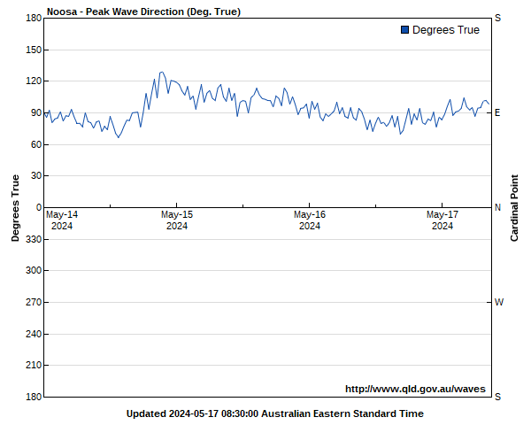
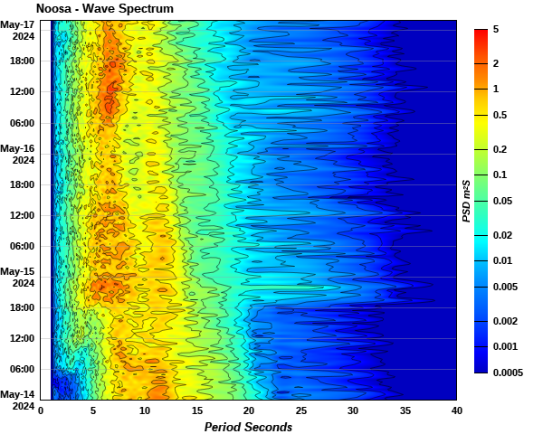
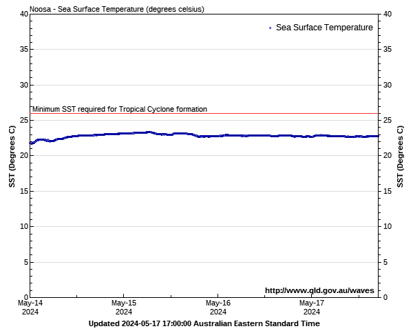
Sunshine Coast Waters: Double Island Point to Cape Moreton Wave Buoys
Lat: 26°53'54.6"S
Lon: 153°16'43.8"E
Water depth: 35 m
Source: Queensland Government (Department of Environment, Science and Innovation).
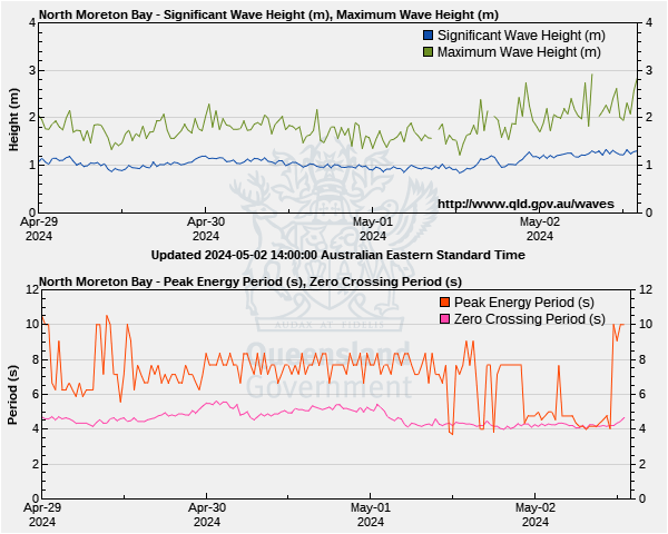
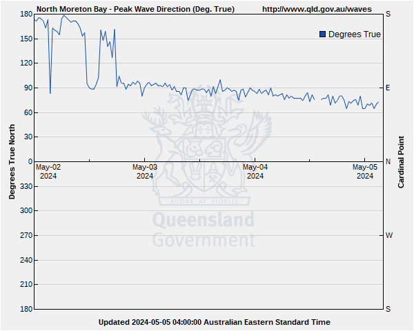
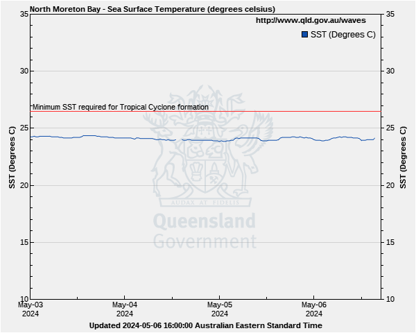
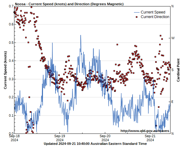
Lat: 26°50'51.3"S
Lon: 153°09'20.4"E
Water depth: 12 m
Source: Queensland Government (Department of Environment, Science and Innovation).
Lat: 26°33'57.6"S
Lon: 153°10'52.2"E
Water depth: 32 m
Source: Queensland Government (Department of Environment, Science and Innovation).
Lat: 26°21'37.1"S
Lon: 153°07'35.0"E
Water depth: 25 m
Source: Queensland Government (Department of Environment, Science and Innovation).
Lat: 25°45'37.2"S
Lon: 153°12'11.9"E
Water depth: 32 m
Source: Queensland Government (Department of Environment, Science and Innovation).