NE Gulf Carpenteria
North East Gulf of Carpentaria Forecast
By the Bureau of Meteorology
Today’s weather chart

North East Gulf of Carpentaria Forecast
By the Bureau of Meteorology
A ridge extends over the Gulf waters and will persist for several days.
Forecast issued at 02:03 am EST on Wednesday 26 June 2024.

Forecast for Wednesday until midnight
| Wind | Southeasterly 10 to 15 knots, reaching up to 20 knots offshore north of Cullen Point during the morning. |
| Seas | Around 1 metre. |
| Swell | Below 0.5 metres. |
| Weather | Partly cloudy. |
Thursday 27 June
| Wind | Southeasterly 15 to 20 knots. |
| Seas | Below 1 metre, increasing to 1 to 1.5 metres offshore. |
| Swell | Below 0.5 metres. |
| Weather | Partly cloudy. |
Friday 28 June
| Wind | East to southeasterly 15 to 20 knots. |
| Seas | Around 1 metre, increasing to 1 to 1.5 metres offshore. |
| Swell | Below 0.5 metres. |
| Weather | Partly cloudy. |
Current Weather
Latest BOM Weather Stations Data
Anemometer Location: Lat -12.678 Lon 141.921. 17.96 m above sea level.
- Wind ESE 15kts
- Gusts 18kts
- Temp 31°C
- Rain 15:20pm 0mm
Anemometer Location: Lat -12.617 Lon 142.087
- Wind E 7kts
- Gusts 9kts
- Temp 30.2°C
- Rain 15:20pm 0mm
Anemometer Location: Lat -12.785 Lon 143.305. 18.5 m above sea level.
- Wind SE 11kts
- Gusts 12kts
- Temp 27.1°C
- Rain 15:20pm 9.6mm
Anemometer Location: Lat -13.761 Lon 143.118. 159.3 m above sea level.
- Wind E 7kts
- Gusts 9kts
- Temp 28.1°C
- Rain 15:20pm 0mm
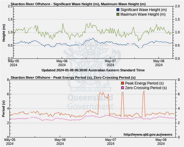
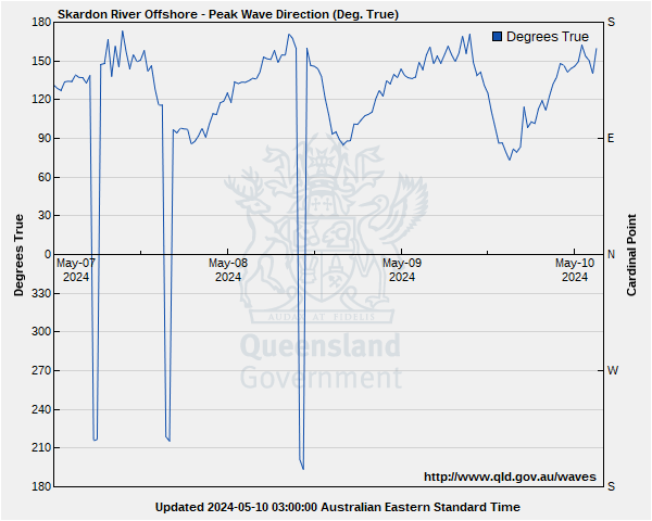
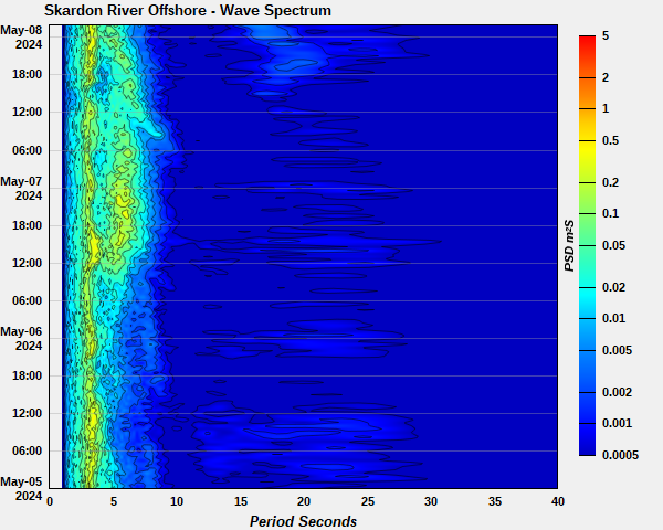
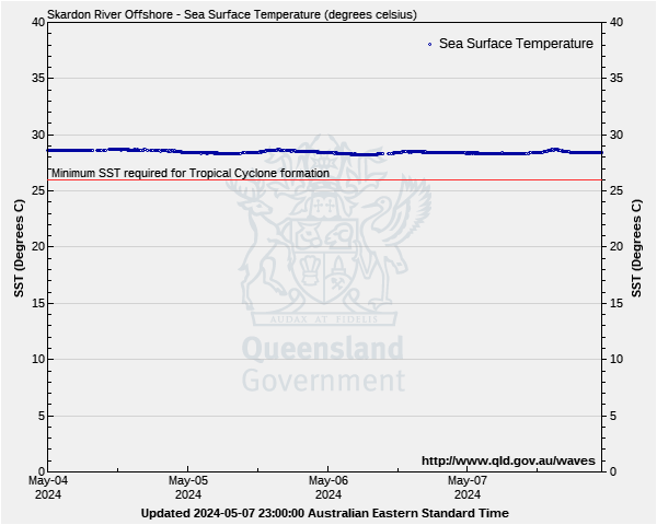
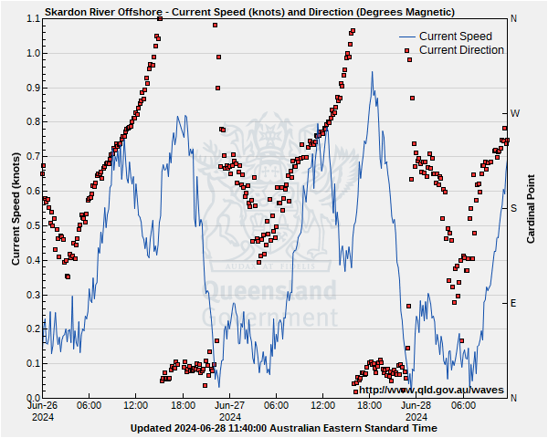
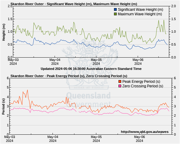
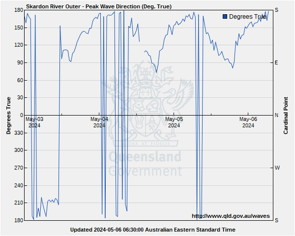
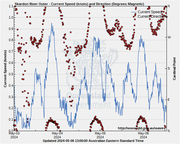
North East Gulf of Carpentaria Wave Buoys
Lat: 12°41'16.8"S
Lon: 141°41'04.8"E
Water depth: 12 m
Source: Queensland Government (Department of Environment, Science and Innovation).
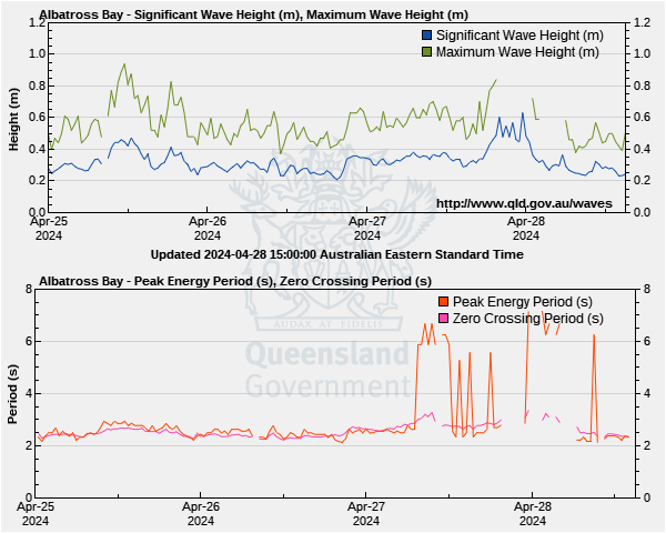
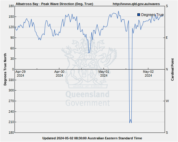
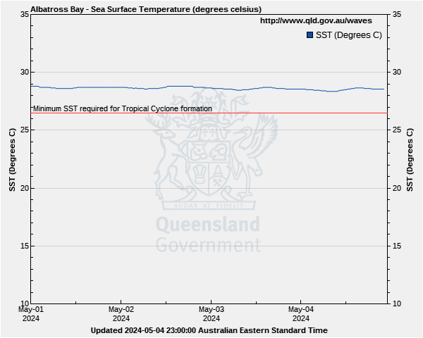
Lat: 11°44'44.3"S
Lon: 141°50'12.4"E
Water depth: 22 m
Source: Queensland Government (Department of Environment, Science and Innovation).
Lat: 11°43'21.6"S
Lon: 141°43'14.3"E
Water depth: 12 m
Source: Queensland Government (Department of Environment, Science and Innovation).