Mackay Coast
Mackay Costal Waters: Bowen to St Lawrence Forecast
By the Bureau of Meteorology
Today’s weather chart

Mackay Costal Waters: Bowen to St Lawrence Forecast
By the Bureau of Meteorology
A ridge extends over the north Queensland waters. The ridge will strengthen slightly from Friday as a high moves into the Tasman Sea and then moves east.
Forecast issued at 02:21 am EST on Wednesday 26 June 2024.

Forecast for Wednesday until midnight
| Wind | East to southeasterly 10 to 15 knots, reaching up to 20 knots offshore between Hamilton Island and Mackay in the late evening. |
| Seas | Around 1 metre. |
| Swell | Below 0.5 metres. |
| Weather | Cloudy. 60% chance of showers. The chance of a thunderstorm. |
Thursday 27 June
| Wind | East to southeasterly 10 to 15 knots, reaching up to 20 knots offshore north of Hamilton Island early in the morning. |
| Seas | Around 1 metre. |
| Swell | Below 0.5 metres. |
| Weather | Cloudy. 60% chance of showers. |
Friday 28 June
| Wind | Easterly 10 to 15 knots. |
| Seas | Below 1 metre. |
| Swell | Below 0.5 metres. |
| Weather | Partly cloudy. |
Saturday 29 June
| Wind | Easterly 10 to 15 knots. |
| Seas | Below 1 metre. |
| Swell | Below 0.5 metres. |
| Weather | Mostly sunny. |
Current Weather
Latest BOM Weather Stations Data
Anemometer Location: Lat -21.117 Lon 149.217. 30.26 m above sea level.
- Wind SSE 9kts
- Gusts 11kts
- Temp 19°C
- Rain 15:30pm 89.4mm
Anemometer Location: Lat -21.171 Lon 149.179. 5.3 m above sea level.
- Wind SSE 12kts
- Gusts 14kts
- Temp 19.3°C
- Rain 15:30pm 61.2mm
Anemometer Location: Lat -21.17 Lon 149.152. 10.31 m above sea level.
- Wind N/A
- Gusts N/A
- Temp 19.4°C
- Rain 15:30pm 66mm
Anemometer Location: Lat -20.366 Lon 148.954. 58.66 m above sea level.
- Wind SSE 19kts
- Gusts 22kts
- Temp 20.4°C
- Rain 15:30pm 79.6mm
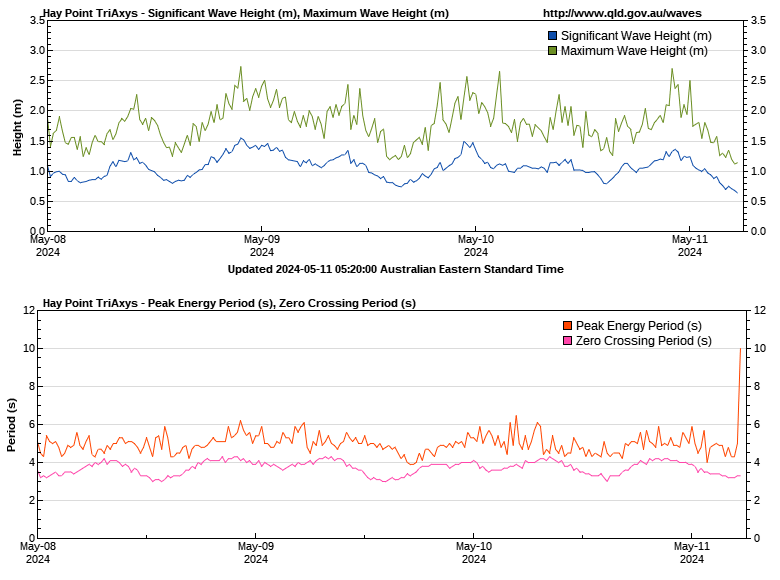
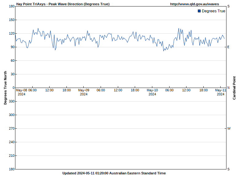
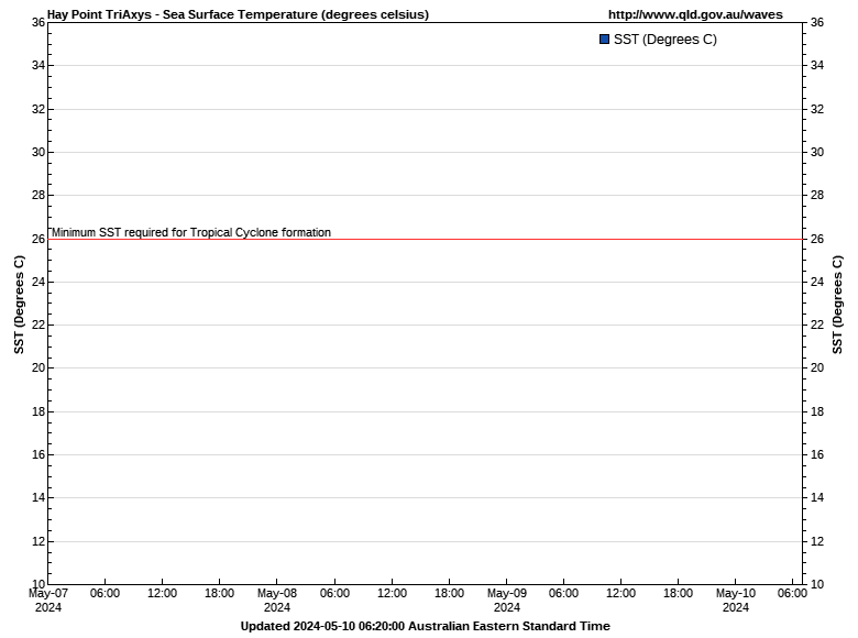
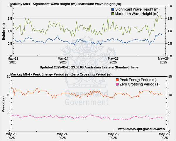
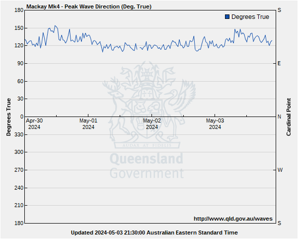
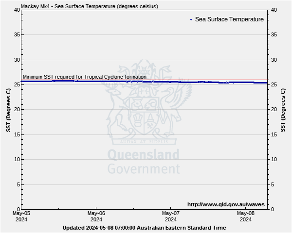
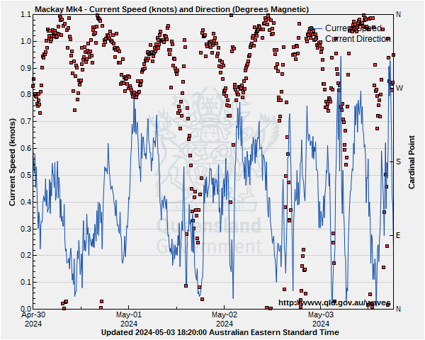
Mackay Costal Waters: Bowen to St Lawrence Wave Buoys
Lat: 21°02'23.9"S
Lon: 149°32'45.5"E
Water depth: 34 m
Source: Queensland Government (Department of Environment, Science and Innovation).
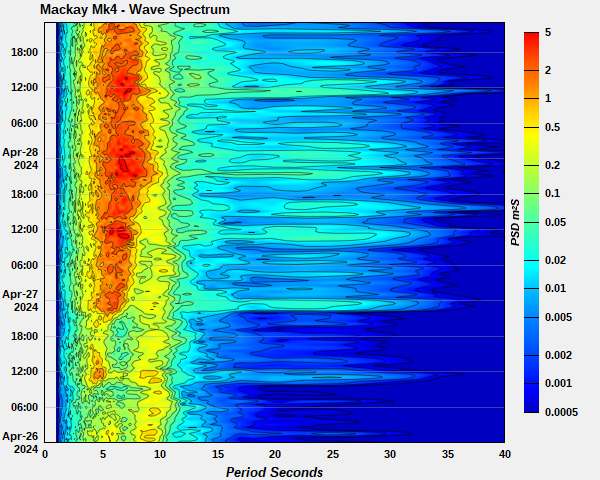
Lat: 21°06'26.3"S
Lon: 149°14'22.4"E
Water depth: 12 m
Source: Queensland Government (Department of Environment, Science and Innovation).
Lat: 21°13'37.2"S
Lon: 149°17'49.2"E
Water depth: 12 m
Source: Queensland Government (Department of Environment, Science and Innovation).