Gold Coast
Gold Coast Waters: Cape Moreton to Point Danger Forecast
By the Bureau of Meteorology
Today’s weather chart

Gold Coast Waters: Cape Moreton to Point Danger Forecast
By the Bureau of Meteorology
A high [1021 hPa] in the Tasman Sea extends a ridge over the south Queensland waters. A weak trough will move east across the south Queensland waters late on Thursday. A new high will move into the Tasman Sea on Friday, extending a new ridge over the south Queensland waters.
Forecast issued at 02:03 am EST on Wednesday 26 June 2024.

Forecast for Wednesday until midnight
| Wind | Northerly 10 to 15 knots decreasing to about 10 knots in the morning. |
| Seas | Below 1 metre. |
| Swell | Easterly below 1 metre. |
| Weather | Partly cloudy. |
Thursday 27 June
| Wind | Variable about 10 knots. |
| Seas | Below 1 metre. |
| Swell | Easterly around 1 metre. |
| Weather | Cloudy. 70% chance of showers. |
Friday 28 June
| Wind | South to southwesterly 10 to 15 knots turning southeasterly 15 to 20 knots during the afternoon. |
| Seas | Around 1 metre. |
| Swell | Northeasterly around 1 metre. |
| Weather | Partly cloudy. 70% chance of showers. |
Current Weather
Latest BOM Weather Stations Data
Anemometer Location: Lat -27.939 Lon 153.428, Coastal dunes. 3 m above sea level. On the coast.
- Wind NNE 10kts
- Gusts 11kts
- Temp 22°C
- Rain 15:10pm 0mm
Anemometer Location: Lat -28.168 Lon 153.505, Airport. 1 m above sea level. 6km from coast.
- Wind N 11kts
- Gusts 13kts
- Temp 22.2°C
- Rain 15:10pm 0mm
Anemometer Location: Lat -28.044 Lon 153.187. 108.15 m above sea level.
- Wind N 2kts
- Gusts 3kts
- Temp 23.1°C
- Rain 15:10pm 0mm
Anemometer Location: Lat -27.971 Lon 152.99. 47.81 m above sea level.
- Wind NW 4kts
- Gusts 4kts
- Temp 23.8°C
- Rain 15:10pm 0mm
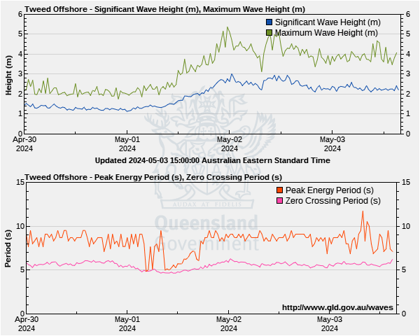
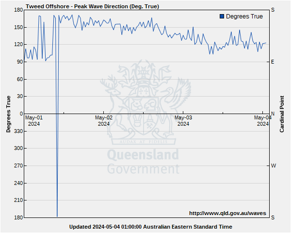
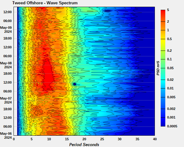
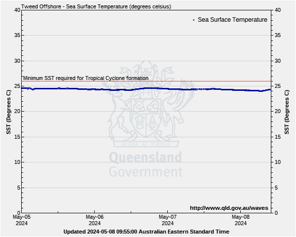
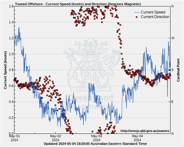
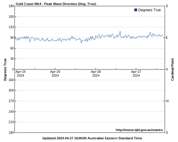
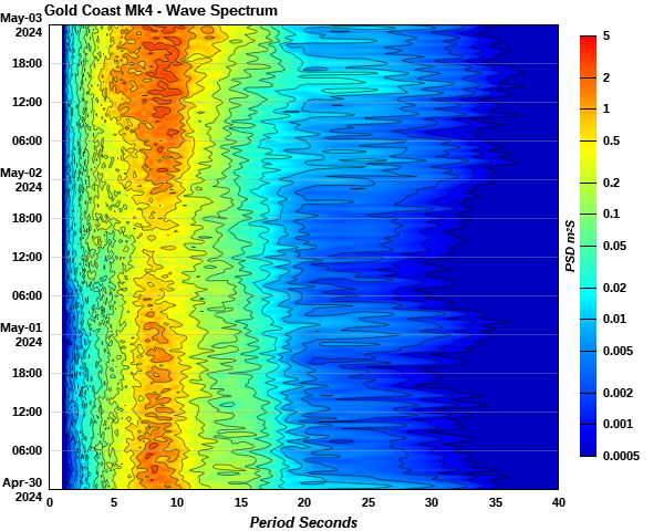
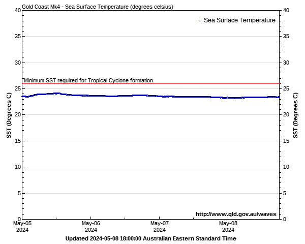
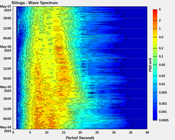
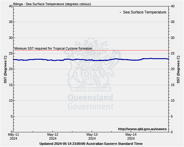
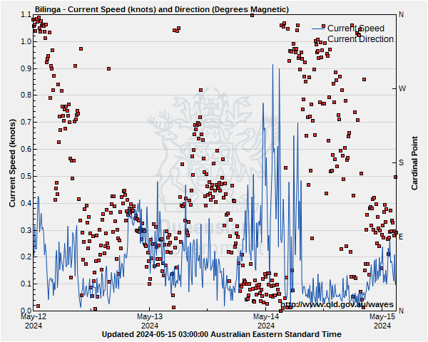
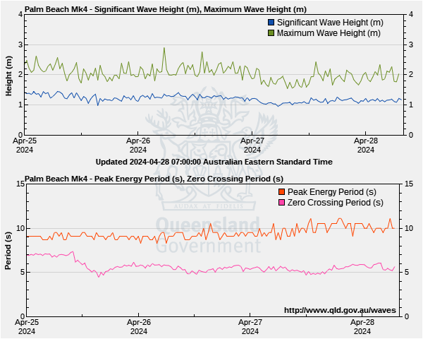
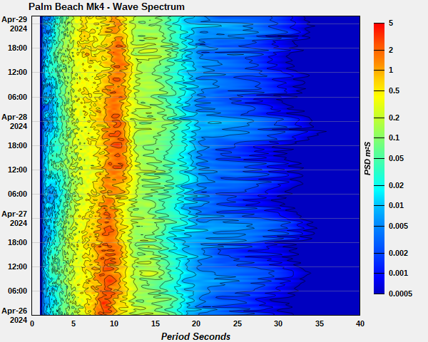
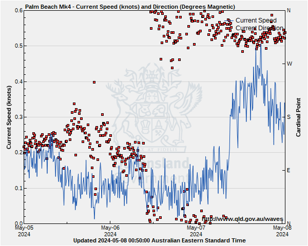
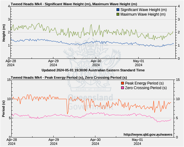
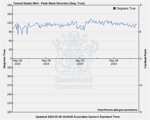
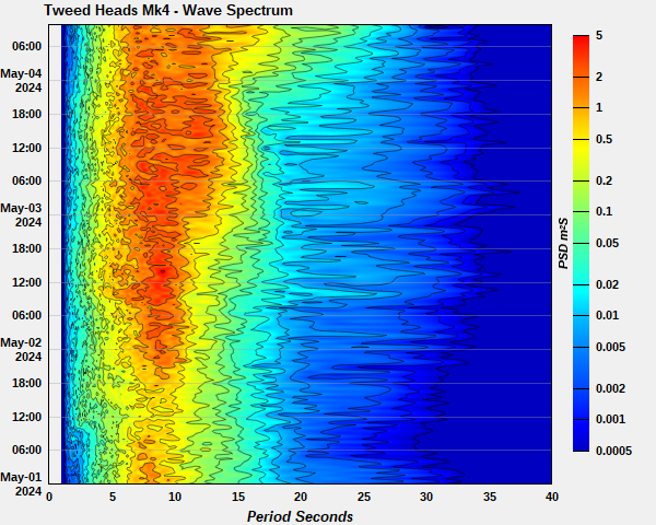
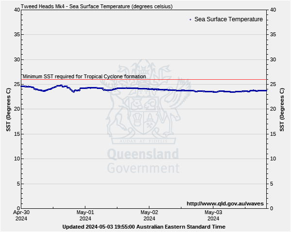
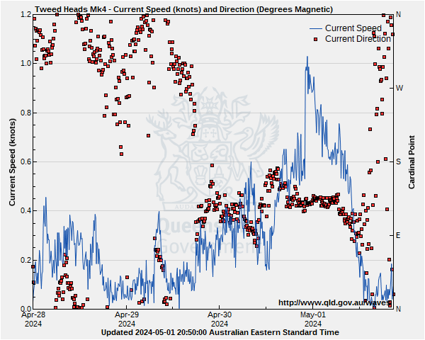
Gold Coast Waters: Cape Moreton to Point Danger Wave Buoys
Lat: 27°57'54.8"S
Lon: 153°26'33.3"E
Water depth: 17 m
Source: Queensland Government (Department of Environment, Science and Innovation).
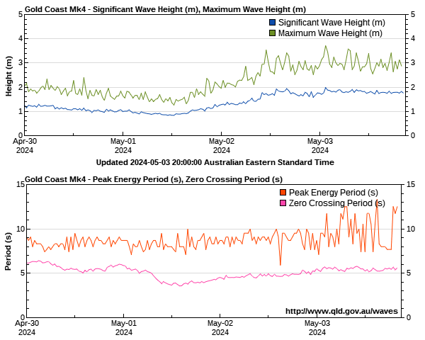
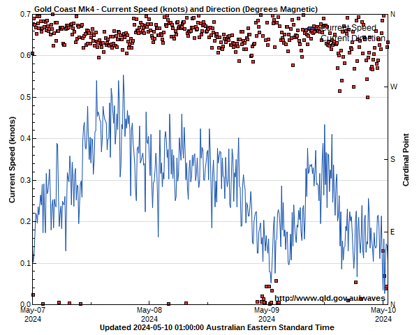
Lat: 28°08'34.9"S
Lon: 153°30'38.8"E
Water depth: 18 m
Source: Queensland Government (Department of Environment, Science and Innovation).

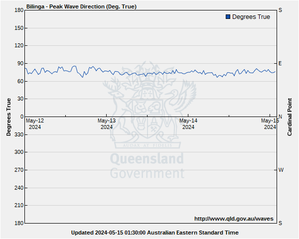
Lat: 28°05'57.3"S
Lon: 153°28'56.5"E
Water depth: 23 m
Source: Queensland Government (Department of Environment, Science and Innovation).
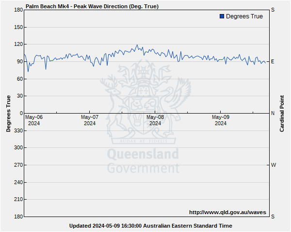

Lat: 28°10'39.3"S
Lon: 153°34'35.6"E
Water depth: 22 m
Source: Queensland Government (Department of Environment, Science and Innovation).
Lat: 28°12'45.2"S
Lon: 153°40'48.6"E
Water depth: 60 m
Source: Queensland Government (Department of Environment, Science and Innovation).