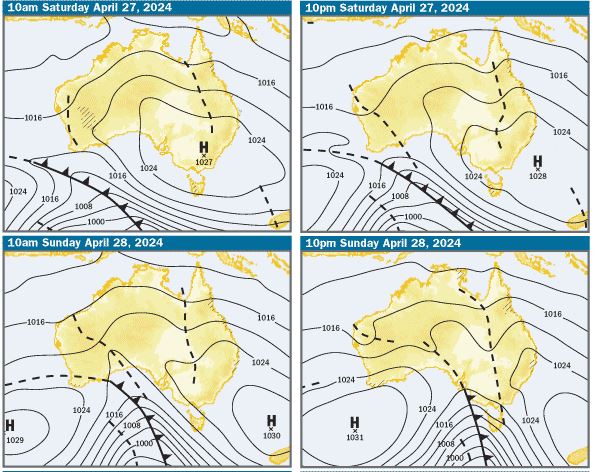
Charts: The charts and weather models are indicating that there’ll be a large high pressure system centred over Victoria on Saturday morning, moving into the southern Tasman Sea east of Bass Strait during the day. On Sunday the high looks like moving further SE near New Zealand and on both days will extend a ridge up the Qld coast, resulting in SE winds along the coast
SE Qld Weather Outlook: Based on what the charts are indicating, on Saturday and Sunday, there’s a 60-70% chance of showers. Winds in offshore waters should be 15-20kts SE on both days. On Moreton Bay it looks like light S/SW winds early, becoming 10-15kts SE during the morning. It should be noted that things can change, so it’s always a good idea to check the latest forecasts before enjoying coastal activities
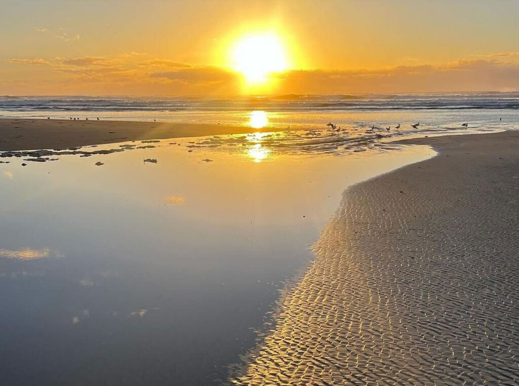
Tides & Moon: It was full moon last Wednesday night, so tidal differences are decreasing as we approach the third quarter or half moon down next Wednesday night. On the weekend there’ll be early morning lows and late morning to the middle of the day highs. Click this link for precise tide times and heights
Pic below – low tide North Stradbroke Island from David May
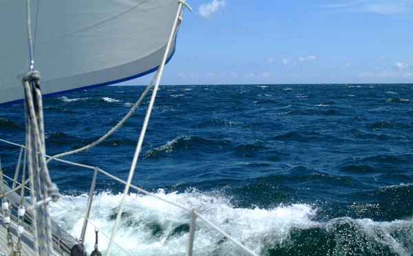
Swell & Coastal Bars: There’s a 1.5m plus S/SE swell in offshore waters and a 1m Easterly swell close inshore. The combination of those two swells is likely to be 1-1.2m E/SE on the coastal bars. As always, take care crossing bars, particularly on the ebb tides when the water running out through narrow bar channels can create pressure waves, which are bigger than swell size and break unpredictably
Pic Below – Noosa Bar this morning from Around Noosa
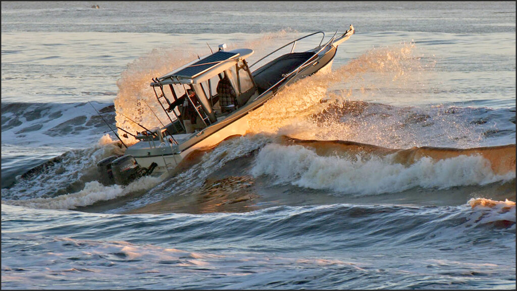
Sailing & Boating: Based on the weather predictions, with showers predicted both days, it’ll be a good idea to take wet weather gear. It looks like good wind for sailing and boating conditions in open Moreton Bay waters will be choppy. In offshore waters, it looks like being pretty lumpy and borderline for small boats. As usual in all but extreme weather, the best cruising and anchorages will be in the sheltered waters from Caloundra to Donnybrook in Pumicestone Passage, the southern bay from Peel Island to the northern parts of Southport Broadwater and in the rivers and creeks
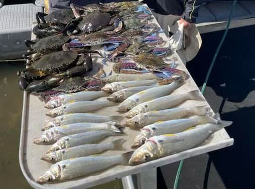
Fishing: If the weather predictions are right, it’s looking like conditions will be borderline for offshore fishing in small boats and a bit lumpy in open bay waters. The best conditions will be in the sheltered waters in Pumicestone Passage, in the southern bay and the rivers and creeks, where there’s been some good fish and crabs caught. To help you plan your weekend angling, the latest SE Qld Fishing Report was published on the Coastwatch web site on Wednesday afternoon this week to cater to Anzac day anglers
Pic below – Whiting, sand & mud crabs caught Tuesday on a trip with Gold Coast guide Ross McCubbin
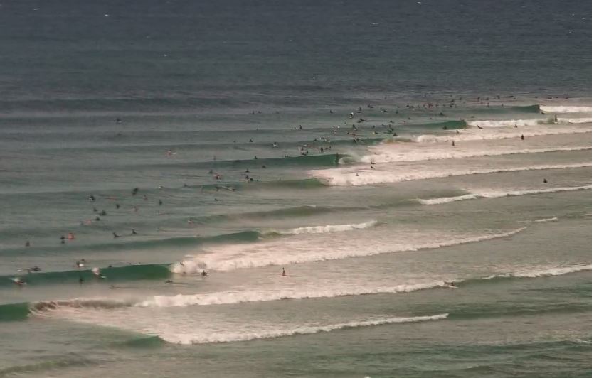
Surf: Based on the weather and swell predictions, expect the swell to be 1m Easterly, with bigger sets. Given the forecast for SE winds, the best waves will be on the the point breaks, which will be crowded, so be nice to each other. There should also be some less crowded beach breaks on the open beaches early, if the wind is S/SW as predicted. You can check the latest surf conditions with the daily Surf Report published about 5.45 every morning
Pic Below – Greenmount today from Swellnet
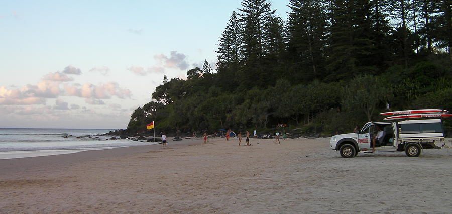
Beach: The weather outlook indicates mostly sunny days, with a few showers, so a mixed bag for going to the beach. In the forecast SE winds, the bays on the northern side of the headlands at Noosa, Mooloolaba, Burleigh, Kirra, Greenmount and Rainbow Bay will be the most pleasant places to be. There’s inshore holes and gutters, particularly on the open stretches of beach and on the ebb tides, any rips working around those features will be enhanced as the water drains off the beach, so swim in the patrolled areas marked by the red and yellow flags. For the latest beach conditions, check our daily Beach Report published about 5.40 every morning
Pic below – Greenmount